Point 1: The route
It is always a sensible idea to check the route when planning your preparation. In terms of getting yourself ready, there are several different factors that can have an influence on how your training should be done in the period leading up race day. These include:
- The length of the route and elevation gain
- The elevation profile of the route
- The highest point on the route
- The surface type
Now, let's go through each point one at a time. But first take a look at the route planner map and the elevation profile:
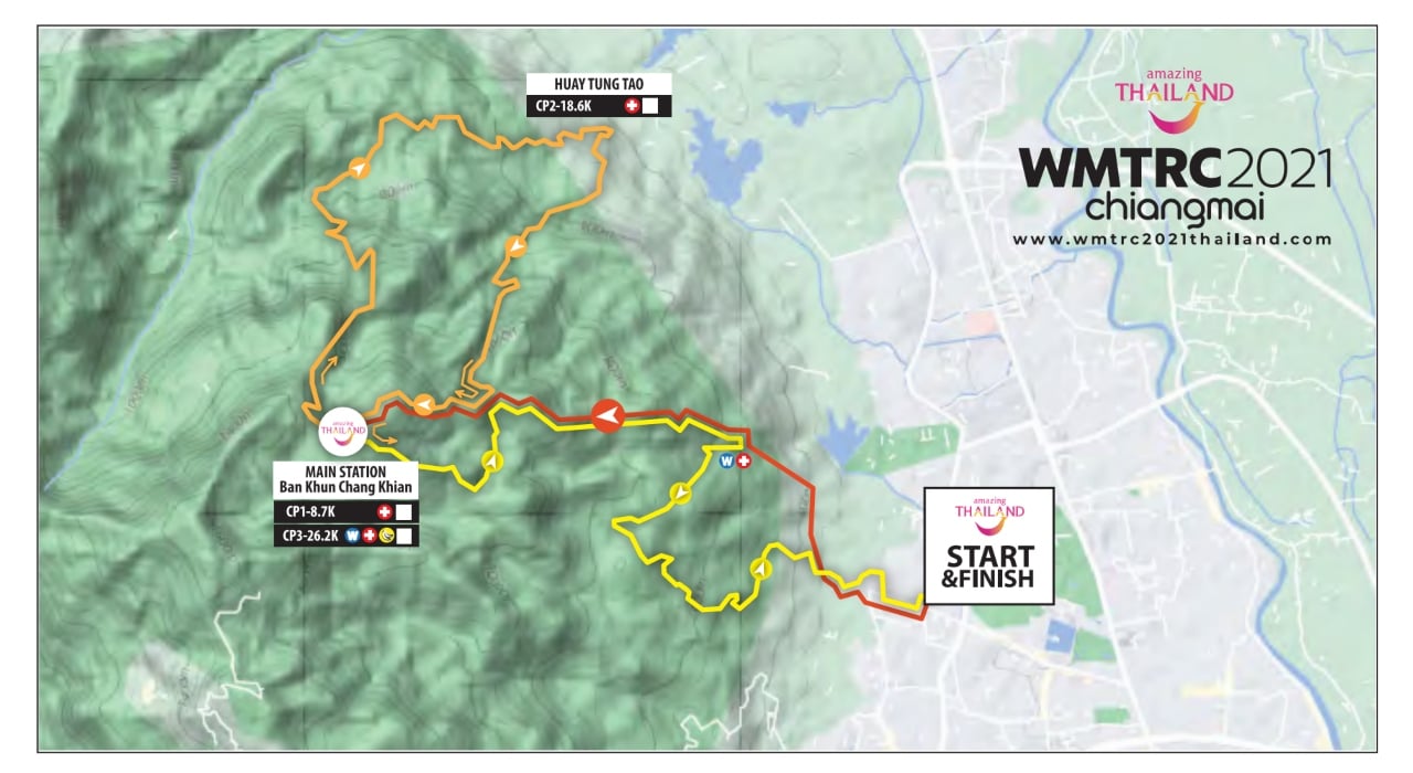
Route planner map
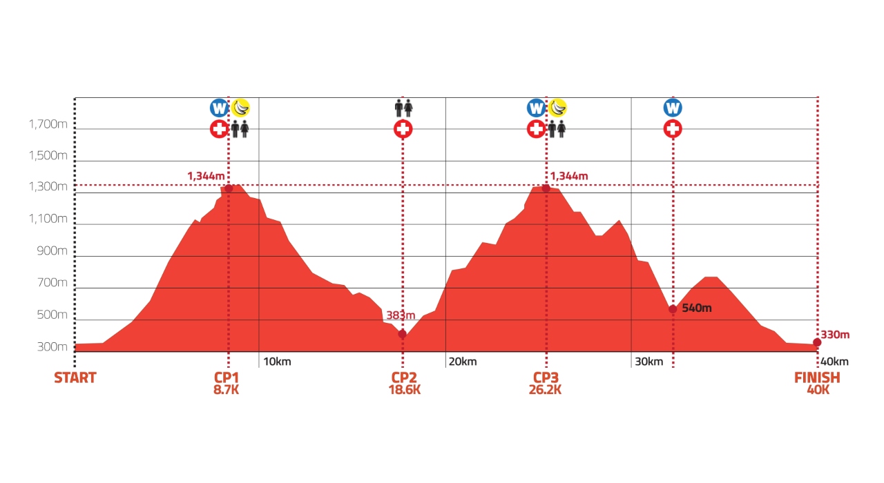
Elevation profile
The length of the route and elevation gain
The total length of the route is 39.3 km. The route starts and ends at the same place in Chiang Mai and has an elevation gain of 2777 meters, according to the elevation profile.
A route that is just under 40 km with an elevation gain of 2777 meters will obviously require quite a bit of time to complete, although I hope reach the finish line quite a while before the cut off, which is a full 8 hours. Such a long race will no doubt demand a lot from my body in terms of my ability to endure, but will also require large quantities of liquids and carbohydrates along the way - but more on that later.
When taking the length of the route and the elevation gain into account, my preparation up to the race will consist of running several long distance runs in hilly terrain. Of course the preparation still has to fit in with my everyday life, but in practice it has meant that I have found time for at least one run a week of around 90 minutes in the area around Himmelbjerget. The runs could probably be even longer, but with both work and family, that's what I can realistically fit into my weekly schedule.
The elevation profile of the route
In trail running, you really only get to see the true face of the challenge you're facing when you're standing in the middle of it. However, if we look at the elevation profile, it seems that the elevation gain is more or less evenly distributed - that being said, when zooming in, it may make sense to divide it up into slightly smaller stretches. In order to be able to do that with this route, I have tried to draw it myself in Garmin Connect, since unfortunately I can't access the GPX file. For this reason, the following should be taken with a grain of salt, and I don't want to make any fixed plans based on it, which I otherwise normally would have done, if I had access to the route file.
From the town, the route starts with a short, flat section measuring just a little more than 1 km. From here the route goes up the mountain, up past a mountain town, "Khun Chang Kian", and at the top the elevation gain has already reached 1000 meters.
The first incline can be split into 3 parts:
- First part of the climb is characterised by a more moderate incline of around 10%
- An approx. 2 km steep section (incline in excess of 20%)
- A more moderate but still steep climb the rest of the way up (incline of around 15%)
The descent from the first peak looks relatively smooth and is approx. 9 km long with a drop of about -10%.
After the descent, you move onto the 2nd hill climb, which also ends at the aforementioned mountain town. This second incline can be split into 4 parts:
- Just over 3 km with an incline of around 17%
- At least 1.5 km with an incline of around 7%
- A kilometer or so with an incline in excess of 20%
- A flat section with a final small "hop" with an incline of up to 20% (elevation gain of 47 meters before reaching the top)
The descent from the 2nd peak also looks relatively smooth, with the exception of a single stretch measuring just over a kilometer with a descent that exceeds -25%. After this, the downhill stretch is broken by a hydration station after approx. 32-33 km with an uphill stretch of approx. 250 meters in elevation and an incline of around 15%. I imagine that a lot of runners will really start to struggle here if they haven't stored a little extra energy.
On the other hand, when you have got past this final minor incline, the route begins to steadily go downwards, ending in the town.
This sort of information is very useful to me, because it helps me know what to expect when I am off running - for example, I will view the first 5 km as a steady incline, after which I know that the degree of incline once again gets slightly more "doable" at around 15 % for the last 3 km before I reach the top.
Carbohydrates and hydration strategy
First of all, it looks like it's going to be very hot weather – the average temperature in Chiang Mai in November is around 30oc! That's why I will need to bring much more liquid along with me this time compared to the last time I ran a trail marathon, which was the Danish long trail competition in January on Bornholm - here I brought with me 1 liter of energy drink.
My plan so far is that I will have to bring about 3 times as much liquid for running in Thailand; i.e. 3 liters of liquid. In addition, I may choose to enhance my chances even more by drinking extra liquid at the 4 stops along the route. I doubt I will end up losing any more fluids, but I don't think I will be able to absorb any more along the way and still be able to run!
As for carbohydrates, it's straightforward: I have very good experience mixing Maurten's "Drink Mix" in my bottles, so I all I have to do is remember to drink from the bottles as opposed to having to remember energy gels etc. So far I have used "Drink Mix 320", but for this run I think I will fill my bottles with the lighter mix ("Drink Mix 160"), since otherwise I risk consuming around 500g carbohydrates, which is probably a little on the high side!
The highest point of the route
When running in highly elevated terrain, there is the additional challenge of less oxygen in the air - however, this won't be a problem in Thailand, since the highest point is no higher than 1344 m. At this elevation, I don't expect any notable challenges regarding low levels of oxygen in the air.
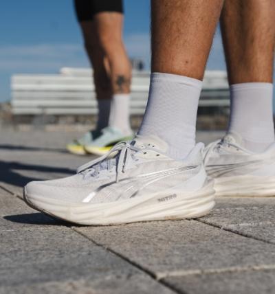
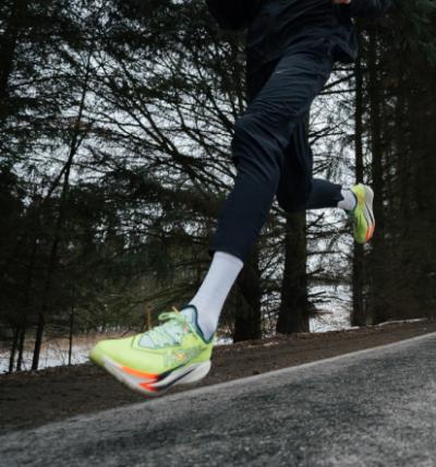
The surface type
The surface type is always an unknown factor, and thus it's often very difficult to be 100% prepared for this before you have seen the surface in reality. For the upcoming run, I will arrive in Chiang Mai a little over a week before the race, so I have the opportunity to investigate the environment before setting off on the race.
If the surface is very technical, uneven and/or muddy, it will mean that I will be running for a longer time, and so I should really choose a firmer and more stable shoe. On the other hand, if the surface is solid, I will be best off choosing a shoe that offers more comfort. But I will have to wait and see when I arrive. There's nothing better than bringing a huge choice of shoes with you to choose between!
Point 2: The heat
The heat is no doubt a very important factor to take account of - especially since I am coming directly from the Danish autumn weather. There are several things you can do to help your acclimatisation process. I have particularly looked at the following 3 things that may help me in the month leading up to the run:
- Sauna
- ”Sweat clothing”
- Treadmill
Sauna
Going in the sauna seems to be quite effective when it comes to acclimatisation. Physiologically speaking, sitting in a sauna will increase your blood volume, and perhaps even increase the production of red blood cells, which in turn will be beneficial in terms of how well you are able to perform. The increased blood volume also plays a crucial role in relation to the body's ability to cool down.
The most recent sauna trial I've seen involved runners sitting in a sauna straight after having done exercise over a 3 week period. They sat in the sauna 12.7 times on average during the 3 weeks, which is approx. half an hour each time (in a hot and humid sauna).
The conclusion that was drawn from this experiment was that the blood plasma increased by 7.1% ("the water in the blood") and a 3.5% increase in red blood cells. The experimental group was also tested on performance in an all out test (as long as possible at the runners' 5 km PR pace), and compared to the control group the experimental group improved by an incredible 32%!
”Sweat clothing”
"Sweat clothing" simply means running with far too many clothes on. This approach does not seem to have as good an effect as sitting in the sauna, and should probably be regarded as a "better safe than sorry" approach. The effect is probably small, but still well worth trying.
In my preparation, all I have to do is make sure that I am wearing plenty of clothes, but I don't do any more than that given that the real effect only seems to be rather small.
Treadmill
If you've run on a treadmill, you've no doubt felt how hot it can get, particularly if you don't have a fan running. It's as though the air isn't getting replaced, so it just gets warmer and more humid the longer you run.
In addition to this, of course it's much easier to get practise running as higher temperatures, since the treadmill is inside.
For this reason, in terms of my preparation, I use the treadmill for a mixture of both relaxed runs and interval training - all with the fan off, and I've even done a few runs with long sleeves on - and let me assure you that I sweat, a lot! The challenge here is of course the surface type, which has no real relevance in terms of trail surfaces – that's why I also prioritise running outside on the right type of surface.
Sources
- Scoon, G. S. M., Hopkins, W. G., Mayhew, S., & Cotter, J. D., Effect of post-exercise sauna bathing on the endurance performance of competitive male runners (2007)
- Dawson B., Exercise training in sweat clothing in cool conditions to improve heat tolerance (1994)
- Dawson B, Pyke FS, Morton AR., Improvements in heat tolerance induced by interval running training in the heat and in sweat clothing in cool conditions (1989)